Label Cloud
Saturday, September 30, 2006
Sunset

Friday, September 29, 2006
Aspens
Token Aspen Shot

Wispy Cirrus Clouds

Lenticular Cloud on the Lee-Side of Grand Mesa
The real name for this cloud is Alto-cumulus Standing Lenticular and it can reveal the presence of a mountain wave. Judging by the amplitude (curve) of the cloud and it's location on the downwind side of Grand Mesa I would say that a mountain wave is present, but not turbulent.

Tuesday, September 26, 2006
Dumb and Dumber Construction

Three weeks ago I got sucked into designing and helping build a deck in Denver for my friend Doug. Actually, I wasn't going to let a project like that go down without jumping in and designing the most complicated deck possible. Ten years of not building decks has taken it's toll on my skills, but so far injuries have been minor and progress has been good. Plus, I've mastered the art of framing and playing fetch with Molly at the same time.
Frame from the North Side
Chris (another pilot/ex-deck builder) got sucked into the project too and has brought with him much needed experience and expertise. Between the three of us we have managed to solve every issue of my complicated design.
Frame from the East Side
I made this sign to remind everyone why we've spent hours trying to figure the simplest things out, why I cut through the chord on the circular saw, and why I shot my hand (or Doug, almost) with the nail gun.

Written in Blood after Slicing my Hand Open
The framing, footers, and electrical are done and my goal is to have the decking done by Sunday. I'm going to layout a herring bone on each level. When it's done it should look this one on my Mom's deck.

Monday, September 25, 2006
The Wide-Open Sports Car

I stumbled on this picture in an Ebay auction. It was a poster that someone was printing on tee-shirts and trying to sell. The printing and the shirts were both of poor quality and the starting bid was way to high. Needless to say I didn’t bid, but I really liked the poster. 1976 was the year I was born and it combines two of my favorite things, hang gliding and British sports cars.
In the late 70's MG and it’s parent company British Leyland were struggling to stay in business. Increased US emissions and safety standards, poor management, quality control problems, and competition from reliable Japanese sports cars were all hurting sales. It’s probably no coincidence that MG chose to put a hang glider in its advertisement. Hang gliding was a new technology then and British Leyland was trying to modernize its image from that of a classic auto maker.
The hang glider appears to be a Rogallo-based planform. Maybe an early Wills Wing Standard? I have no idea, but if someone can identify it please post a comment. The top half of the image reminds me of a flying site in Santa Barbara, but again, I am unsure. The clouds are typical of a Southern California marine layer so it must be somewhere in that region. I can just imagine the conversation taking place on the lower half of the image. I’m sure it started with a "Yeah, man . . . " I’ve had a few of those conversations.
It would be a cool project to try to replicate this picture. Jeff, Adam?? Maybe on the South Side of Point of the Mountain next time I’m in Utah with an MG and a hang glider. The odds of my MG making it 500 miles through the Rockies (which is too small to carry a hang glider anyway) are not good, but stranger things have happened.
Here is what the print on the poster reads:
To everyone who longs to soar free, we dedicate this 1976 MGB.
Like all the great MGs of the past 50 years, wide-open, wind-in-your-hair performance is built into this newest MGB. This car holds the current Sports Car Club of America National Championship in E Production - as it has for four of the last five years. MGB’s lively performance and crisp handling come from radial tires, front disc brakes, sports car suspension, short-throw, four-speed stick, rack and pinion steering and a race-proven 1798cc engine.
There’s a big, wide world out there. And MGB lets you enjoy it all. Just open wide, and say "AH!". For the name of the MG dealer nearest you, call these numbers toll-free: (800) 447-4700, or, in Illinois, (800) 322-4400. British Leyland Motors Ind., Leonia New Jersey - 07605.
Sunday, September 24, 2006
Failed Fall Hang Gliding Epic (Beer Thermals)
After a night of indecision between Adam, Jeff, and I we still have no good plan on where to meet this weekend. Dinosaur is out, Grand Mesa is out, and the weather in Paradox and Moab doesn't look good. Getting air time, much less a 100 mile cross country flight, is not looking good in the mountains due to snow. I woke up frustrated this morning and headed to Look Out Mountain in Golden. When I checked the weather the winds were blowing down the face (not good), but I had a feeling things would turn around once the valley started heating up.
View of Launch from the LZ
Saturday, September 23, 2006
Electrical Fire
The MG with a reliable means of transport on the boot - just in case!

Friday, September 22, 2006
Fall Epic (prologue)

Friday, September 15, 2006
Dino-soaring
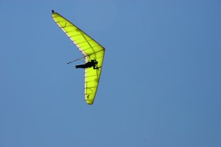 The monsoon season made an early appearance in Colorado this summer shutting down most of the hang gliding for the first part of July with lots of rain and thunderstorms. My mysterious knee injury has forced me to take a break from running, cycling, racing, or any other strenuous activity. The forced sedentary lifestyle is killing me! I feel like I should hook up my TV, start eating fast food and shopping at Walmart! Needless to say my adventure level has been deficient. Last week a massive high pressure moved into the Four Corners region blocking the monsoonal flow into CO which opened a window of opportunity for good flying. Seizing the moment, a contingent of Front Range pilots headed to Dinosaur National Monument. Dinosaur was home to the 1998 Hang Gliding Nationals and has great cross-country (XC) potential. The conditions looked excellent and there was even a retrieve driver, the only problem was I had to work all week. My only hope was the window would stay open long enough for me to make it out there Saturday afternoon. Thursday I heard tales of BJ flying 102 miles with everybody getting 30 mile plus flights. By Friday night the truck was packed and Molly Dog was off to Denver so I could grab her on my way out of town. I had to work one round trip Saturday morning and I was out! I landed at DIA at 11:30 a.m. and was through the Eisenhower tunnel by 1:30 p.m.
It didn't look like I would make Dinosaur in time to fly Saturday so I headed to Williams Peak instead. Williams Peak is located between Silverthorne and Kremling west of Green Mountain Reservoir. As I got close, I could hear other pilots in the air over the radio. Steve was at 16,000' nearing cloud base, Shawn was at 14,000' and climbing, and a couple others had sunk out. I picked up Kent who landed in a landing zone (LZ) called the Postage Stamp and we headed up to launch.
Ready to hook in at Williams

Launching at Williams
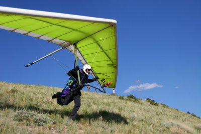
I rushed to rig my glider and get in the air before the lift shut down. I launched at about 3:30 p.m. in a good cycle. This would be my first flight with a pair of recently purchased carbon fiber winglets. These increase the glide, but make it harder to turn so I didn't want to fly too close to the hill until I got a feel for them.
Just after Launch, Williams
Green Mountain Reservoir
I headed out to the valley passing up the lift on launch which proved to be a mistake. As I flew out toward Green Mountain Reservoir I found nothing. The lift had shut down. I found broken 50 feet per minute (FPM) up at 300' above ground level (AGL). The thermal was drifting away from the lake and I had to leave after a couple turns to keep the LZ within glide. A nice crowd of water skiers and boaters had gathered to watch my landing. No pressure! After a nice wing-over to please the crowd I skimmed in over the lake for a great no-step landing.
As I was breaking my glider down, I heard over the radio that Jim had flown 128 miles from Dinosaur to Steamboat and was in need of a ride. I decided to head north and give him a ride back to Dinosaur. I made it to the Steamboat LZ at sunset, but Jim was no where to be found. He had found a car and gone to retrieve another Steamboat pilot who had flown 50 miles to Kremling. Everyone was going XC! Jim showed up around 9:00 p.m. and after dinner we headed out to Dinosaur. The entire way to Dinosaur I questioned Jim about the site. My focus was on optimal weather, and XC routes. The last hour to launch is on dirt roads north of the town of Dinosaur. Its high desert at about 8000' elevation and is was filled with all manner of wildlife. We were dodging rabbits, jack rabbits, deer, elk, owls, and marmots. A few rabbits last minute decision to run across the road cost them. It took me a while to figure out why Molly was licking my wheel wells the next morning. Nasty! We finally got to launch at 2:30 a.m..
Dinosaur Night
Dinosaur Day
Molly woke me up a dawn. She was ready for action but I was hurting. I managed to doze till about 8:00 a.m., but it wasn't enough. Fred and Ed, two other front range pilots, had arrived on Saturday. After breakfast I set out to scout the area. The launch at Dinosaur sits on top of a 3000' tall wall of rock. The BLM constructed two smooth gravel ramps to launch from. This one of only a few federally maintained hang gliding sites I'm aware of. There is a nice flat area back from launch where you can top-land. There are two LZs are out in the valley a couple miles from launch. The Snake Pit (no explanation needed) is the closest and the Corral is farther out. The day before Ed landed in the Corral in strong midday conditions and broke both downtubes. Neither LZ looked especially appealing to me which just enforced my commitment to fly XC.
Jim Pointing to the Snake Pit

All morning Sunday the desert was heating up and thermal cycles were becoming stronger and stronger on launch. By noon I was itching to get off the ground, but Jim recommended waiting. On Saturday he didn't launch until 2:30 p.m. and struggled at first to get up. High pressure conditions can be hard because it causes the thermals to be tight little rockets. By 2:00 p.m. I couldn't take it any more. I put on my capilene base layer, a thick fleece mid layer, and a wind proof shell. I didn't take long to overheat in the 100 degree temps on launch, but it would be close to freezing if I made it above 16000'. The day before Jim had four climbs to 18000'. I was optimistic!
Alex Launching at Dinosaur
I launched first at 2:30 p.m. in what, from the ground, seemed like good thermal cycles. I fought in broken lift to gain any altitude I could. The thermals were drifting fast over the back of the mountain and the air was turbulent and disorganized. It was pure survival to stay up! To make the Snake Pit LZ you have to leave the mountain at 500' below launch. I found myself 500' below launch a couple times, but decided to gamble that I would lift in front of the mountain. Fred launched next followed by Ed. Fred joined me in the struggle to work anything we could. Ed headed out to the valley and found nothing. Fred got a little low and joined Ed on the way to the Snake Pit. I was hungry for an XC flight and gambled again, going well below 500' in front of launch. My options were to find lift or try to land in the 4' tall juniper trees at the bottom. I didn't consider the latter an option. I found a broken thermal with 50 fpm up and hung with it back to launch. About 200' over launch I found a core (fast rising air within a thermal) and rocketed at 1300 fpm to 10,000'. Fred and Ed had both landed at the same time in the Snake Pit. Two gliders coming into the same tight LZ simultaneously is not a pleasant experience. I've been in that position before and didn't envy them. I radioed Fred for the conditions in the Snake Pit. "HOT!" was his sole reply. That was all the motivation I needed to get out of there. I tucked my arms in and turned West on glide. If I could just make it over a small valley to the west there was a plateau with clouds overhead and plentiful LZs below. It looked like heaven if I could make it. The glide was going to be close. Halfway there I was down to 8500' flying at 40 mph. It was time to find lift. I found nothing but sink. I wasn't going to make the plateau. I needed an "out." At 8000' my only landing option was a small clearing in the junipers, but had doubts about even making that! Just past the clearing was a barbed wire fence on a hill and a road with a gate. I headed straight for the gate. At 400' AGL I threw out a streamer for wind direction, but was going to fast to keep it in sight. I reached the gate at 70' AGL, kicked my feet out and dove into my turn to final. I cleared the gate by about 10' and hit my spot dead center! I was stoked to have avoided the Snake Pit and earned every bit of my 6 mile, hour long flight. Alas, today was not to be my 100 miler. After breaking down my glider I hiked out to the ridge and radioed Fred my position. He said he'd be there in an hour and half. It was 100 degrees. I found some shade under a juniper tree and tried to take a siesta.
Fred Launching at Dinosaur

Dino-soaring
After riding in the back of Fred's truck on the dusty road back to launch I packed up Molly and we headed South. Fred, Ed and Jim all had to work on Monday so they were off back to the Front Range. I made plans to meed Tim, a Montrose based pilot, and fly Crested Butte. Just north of Fruita I was back in cell phone range and got a hold of Tim. It was 7:00 p.m. still 90 degrees. My route took me by Highline Lake State Park. Last year I spend 18 hours riding laps around Highline lake in the 18hrs of Fruita mountain bike race. After a much needed dip and stick throwing Molly and I headed east to Grand Junction.
Molly Dog Coolin' Off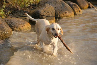
Tim talked to some Crested Butte pilots and the conditions didn't look good for Monday, time for plan B. Flying at work between Grand Junction and Denver I often fly over Grand Mesa. At 10,000' elevation and 30 miles long the name is fitting. Its a lush island of green in the western Colorado desert. The western edge of the mesa is called Lands End and consists of a 500' sheer cliff followed by sloping terrain down to the valley 6000' below. I've heard stories of people flying hang gliders off Grand Mesa, but the cliff launch is dangerous. If the conditions were light, it would be doable. Tim and I decided to meet at the road that goes up to Lands End on Monday morning. It was 9:00 p.m. and I was exhausted. I wanted out of the valley to find some cool air to sleep in. I had to drive up to 8000' on Grand Mesa before it started to cool off.
Milkyway over Grand Mesa
Where I woke up
Molly slept till about 8:00 a.m. which was just enough time to meet Tim. We found an LZ at about 6000' elevation in a forest fire burn area. The fire had burnt most of the junipers and it was relatively flat. The only obstacles were 3' tall juniper stumps burnt into spike shapes. There was enough space to fit a glider between them, but the thought of being impaled on a juniper spike was in the back of my mind the rest of the day. We left Tim's car and headed up to launch.
Molly Dog on Lands End
Lands End from the Air
The view from Lands End was incredible. The weather picture had changed a little from the weekend. A high overcast indicated increased moisture in the atmosphere and the nature of the clouds showed sink in the valley. This was good for launch because the air would be smooth but getting up would be hard because the thermals would be few and far between. The window of error with a cliff launch is very small. On a normal launch you run to accelerate the glider to flying speed. A cliff launch is like going off a high dive. Initially the wing is stalled until it accelerates above stall speed. It happens very fast, but if the glider isn't level as you go off it will enter an uncommanded turn. If the turn progresses beyond 90 degrees, you can hit the rock face below resulting in what Ill call a "non-flying condition." If there is a strong wind blowing up the face a phenomenon called "cliff suck" can occur. A rotor develops at the edge of the cliff creating a wind that can suck a glider and pilot off the cliff prematurely. With calm winds this wouldn't be a factor for us today.
Hucking off Lands End
Tim after Launch
Tim rigged his glider and I hiked over to the visitor center to find some tourists to take pictures. At 11:00 a.m. Tim was ready to launch. I held his keel just in case there was any cliff suck. Tim yelled "Clear!"; had a great launch and disappeared over the edge. As the tourists watched, Tim flew out over the valley I hooked into my glider. With the overcast skies and "sinky" clouds I expected we would both have a gentle glide down to the LZ. As I turned my glider around someone yelled "he's climbing!" He hooked a thermal and was climbing slowly. I rushed to get into position. I put every tourist there to work. One person was holding my keel, another was taking pictures, one was on each wing, and another was calling out wind direction. With my glider level and the wind calm I hucked off into the abyss. The more vertical you can get, the better because you accelerate faster and have control of the glider sooner. I balled up and kept my head down. Once clearing the launch, I tucked into my aero position and headed straight for Tim who was still climbing in light lift. I hit about 300 fpm up below his glider at 8000'. I stayed with it until it started dying at about 10,000'. I headed out further into the valley and caught three more thermals getting to about 10,000' each time. The sink between each thermal was getting stronger and the lift was getting lighter. The monsoon season was back. It was only noon and storms were already starting to develop. A nasty little cell (developing thunderstorm) was getting closer by the minute from the west. I headed out to the LZ and touched down between two "juniper spikes." Tim landed shortly after me. We broke down and headed back up to launch.
Wildflowers (Grand Mesa background)
At work the week before I had noticed a waterfall on Grand Mesa north of Lands End. It was a much longer hike than it looked from the air, but with killer views from the edge of the mesa and wild flowers abound I didn't mind. I could hear it and feel water drops in the air before I could see it. As the cascading tower of water came into view I was awe struck. A small stream surrounded by wild flowers with little pools just disappeared over the 500' cliff. Molly and I took a dip in the pool closest to the edge. The stream was fed by run off and the water was COLD! I was so caught up in how awesome this swimming hole was I failed to notice the storm building behind me. Being the tallest thing around on a 10,000' mesa is not good odds for lighting avoidance. After a frantic lighting filled run back to the truck I decided to head back to Boulder.
Clearcreek Waterfall from the Air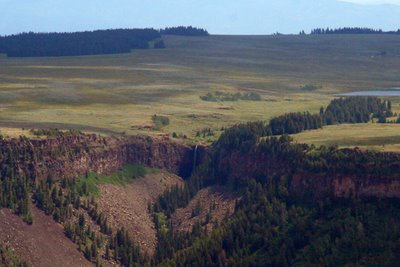
On the Edge
Coolin' Off
Wildflower Waterfall
Air time in Colorado has proved much more fleeting than in Utah or California. In my three-day mission I didn't get my 100-mile flight, but I did fly three different sites, three days in a row. A new record for monsoonal Colorado. The Big Spring meet is coming up in Texas and fall will be much dryer. I'm still and optimist!


